

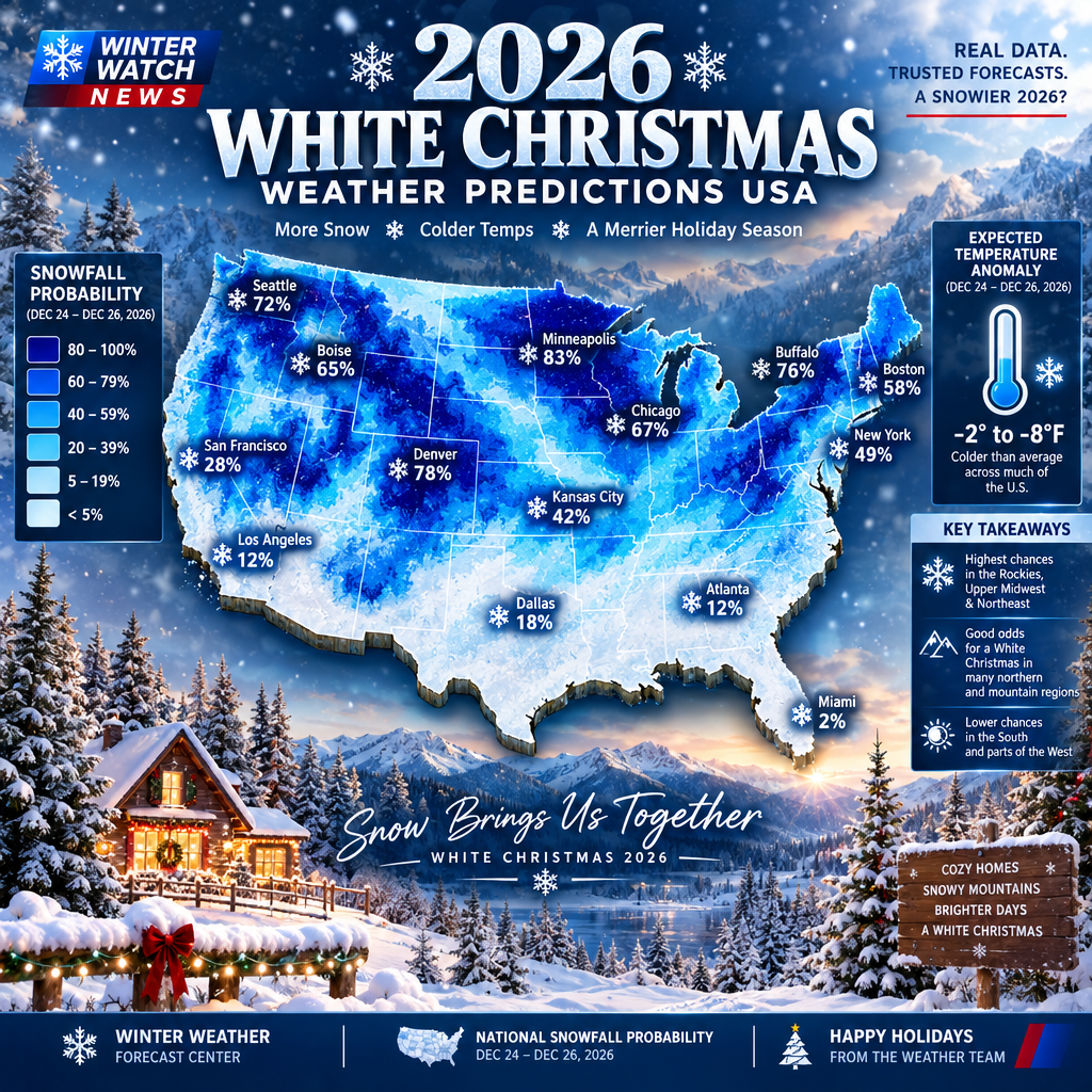
The holiday season is approaching, and millions of Americans are already wondering whether December 25, 2026, will bring snow-covered streets, frozen landscapes and a traditional white Christmas. The latest winter weather outlook from the National Oceanic and Atmospheric Administration (NOAA) offers an early look at the conditions that could shape the upcoming winter across the United States.
According to NOAA’s October 15, 2026, winter outlook, warmer-than-average temperatures are favored across much of the northern United States, including the Pacific Northwest, Midwest, Mississippi Valley and parts of the East. Meanwhile, wetter-than-average conditions are more likely across the southern United States and along the East Coast.
These predictions provide important clues about the 2026-27 winter season, but they do not determine whether a particular city will have snow on Christmas Day. Seasonal outlooks measure broad temperature and precipitation patterns rather than predicting snowfall on a specific date.
For people planning Christmas vacations, winter holidays or family travel, the early outlook is still worth watching. The biggest question is whether colder weather and suitable storm systems will develop in the regions where historical data already favors a white Christmas.
What the Latest NOAA Winter Forecast Says About Christmas 2026
NOAA released its 2026-27 U.S. Winter Outlook on October 15, 2026. The outlook covers December 2026 through February 2027 and highlights the expected influence of a strong El Niño climate pattern.
The agency favors above-average winter temperatures across several northern regions. These include:
- Pacific Northwest and northern California.
- Midwest and Upper Mississippi Valley.
- Mississippi Valley.
- Much of the eastern United States.
- Alaska.
Parts of the Southeast, including Florida, have a greater likelihood of near-normal seasonal temperatures.
The precipitation outlook presents a different picture. NOAA favors wetter-than-average conditions across the southern tier, stretching from the Southwest toward the Southeast, as well as along the East Coast.
This combination matters for Christmas weather. More precipitation does not automatically mean more snowfall. Temperatures must remain cold enough for precipitation to fall and accumulate as snow.
The November monthly outlook, updated October 31 by NOAA’s Climate Prediction Center, also identifies above-normal temperature probabilities across much of the northern United States and both coasts. However, forecasters note that changing atmospheric conditions could affect the pattern.
Why El Niño Matters for the 2026 White Christmas Forecast
El Niño is one of the major climate influences expected to shape the 2026-27 winter.
It develops when ocean temperatures in parts of the central and eastern equatorial Pacific become warmer than normal. This can influence atmospheric circulation, including the position and strength of the jet stream.
During many El Niño winters, the jet stream shifts southward and eastward. This pattern can increase storm activity across parts of the southern United States while reducing snowfall in some northern areas.
However, every El Niño winter is different. Other atmospheric patterns, including the Arctic Oscillation and polar vortex behavior, can influence temperatures and storm tracks.
That means the 2026 white Christmas forecast remains uncertain. A warmer seasonal outlook does not prevent a temporary Arctic cold outbreak or a major winter storm from affecting individual states.
Which US States Have the Best Chance of a White Christmas in 2026?
Historical climate records offer a useful starting point for identifying places where Christmas snow is more common.
NOAA’s latest White Christmas probability map uses the 1991-2020 U.S. Climate Normals. It measures the historical likelihood of at least one inch of snow being on the ground on December 25.
The data highlights several northern and mountainous regions as strong candidates for a white Christmas.
1. Minnesota and Northern Michigan
Minnesota and Michigan’s Upper Peninsula are among the most promising regions for Christmas snow. Their colder winter climates make persistent snow cover more common than in many southern states.
Communities near Lake Superior can also experience substantial lake-effect snowfall when cold air moves across the relatively warmer lake waters.
2. Maine and Northern New England
Northern Maine and parts of New England have a strong historical advantage. Cold temperatures and regular winter weather systems help these areas maintain snow cover during the holiday season.
Northern New Hampshire and Vermont’s higher elevations are also worth watching.
3. Upstate New York
Upstate New York, particularly areas near the Great Lakes and higher elevations, has a better historical chance of a white Christmas than New York City and many coastal communities.
Lake-effect snow can contribute to significant snowfall in parts of western and northern New York.
4. Idaho and the Rocky Mountains
Mountain communities in Idaho, Colorado, Wyoming and Montana often have favorable conditions for Christmas snow.
Higher elevations generally experience colder temperatures, and snow can remain on the ground even when lower-elevation cities experience milder weather.
5. Alaska
Alaska remains one of the strongest candidates for a snowy Christmas because of its colder winter climate. However, local conditions vary considerably across the state.
These are historical climate indicators, not confirmed predictions for December 25, 2026.
Why a Warmer Winter Outlook Does Not Eliminate Christmas Snow
One important detail in NOAA’s forecast deserves attention: seasonal temperature averages do not describe the weather on every individual day.
A region can experience a warmer-than-average winter while still receiving a major snowstorm in December or January.
For example, a cold air outbreak could temporarily push temperatures below freezing across parts of the Midwest or Northeast. If a storm system arrives at the same time, some communities could receive significant snowfall.
The reverse is also possible. A region with a strong historical probability of a white Christmas could experience an unusually mild December, leaving little snow on the ground by December 25.
This is why meteorologists distinguish between climate outlooks and short-range weather forecasts.
White Christmas Definition: How Much Snow Is Needed?
The official NOAA definition provides a clear way to understand the forecast.
A white Christmas generally means at least one inch of snow is present on the ground at the official observation time on Christmas morning, around 7 a.m. local time.
This definition does not require snow to fall on December 25 itself.
A city could receive snowfall several days before Christmas and still qualify if enough snow remains on the ground on Christmas morning.
On the other hand, snow falling during Christmas Day may not meet the traditional definition if it does not produce the required snow depth at the observation time.
Christmas Weather Forecast and Holiday Travel Risks
The 2026 winter outlook also matters to people planning holiday travel.
Snowstorms, freezing rain, strong winds and icy roads can disrupt flights, road trips and public transportation. Travelers heading to colder regions should monitor official weather updates before leaving.
Airline passengers may want to review flight change policies and travel insurance coverage before booking expensive holiday trips. Travel insurance policies differ, so customers should carefully check which weather-related disruptions are covered.
Drivers should also prepare for winter road conditions by checking tire condition, battery health, windshield wipers and emergency supplies.
For homeowners, winter weather planning can include checking heating systems, insulating exposed pipes and reviewing home insurance coverage for relevant winter-related damage.
Important: NOAA’s seasonal outlook is not a travel forecast. Actual winter storm warnings and local snowfall predictions become more useful closer to the event.
When Will the Official Christmas Snow Forecast Become More Reliable?
A dependable Christmas Day forecast will take shape much closer to December 25.
Long-range seasonal outlooks can identify broad climate patterns, but they cannot accurately predict the location, timing and snowfall totals of an individual storm months in advance.
As Christmas approaches, forecasters will have access to shorter-range computer model guidance, updated atmospheric observations and local weather conditions.
For practical planning, travelers and residents should monitor forecasts during the final week before Christmas and pay particular attention to winter storm watches, warnings and winter weather advisories.
Where to Check the Latest 2026 Christmas Weather Updates
Americans looking for reliable snowfall predictions should use official weather information rather than relying entirely on viral social media forecasts.
Useful resources include:
- National Weather Service: Local forecasts, winter storm warnings and weather alerts.
- NOAA Climate Prediction Center: Monthly and seasonal temperature and precipitation outlooks.
- NOAA Climate.gov: Historical White Christmas probabilities and climate explanations.
- National Centers for Environmental Information: Historical climate data and U.S. Climate Normals.
These resources can help readers distinguish between historical snowfall chances, seasonal climate predictions and actual weather forecasts.
What the Early Outlook Means for Christmas Vacation Planning
People planning ski trips, mountain vacations or winter holiday travel should consider both historical snowfall patterns and the latest local forecasts.
Mountain destinations may offer better historical snow prospects, but snow conditions can change from one season to another. Travelers should check resort
